
Newark ZIP Code Coverage
The Newark ZIP code directory begins with the delivery descriptions documented in the research, not a claim that the list is a complete current USPS table. Newark has standard, PO Box, and unique or shared-firm ZIP descriptions. Several have a useful area association, such as Ironbound, Vailsburg, Roseville, Weequahic, Academy, Midtown, or Washington Park. Those labels are postal context only. The live USPS address result remains the way to verify a specific street and current station relationship.
| ZIP | Areas covered | Post office | Notes |
|---|---|---|---|
| 07101 | PO Box Newark description | Live USPS check required | Do not treat as normal street delivery. |
| 07102 | Academy, Midtown, Washington Park association | Newark / Newark NJ S&DC | Postal association, not a neighborhood boundary. |
| 07103 | Standard Newark | NWK-Springfield Ave Station | Verify the exact street in live tools. |
| 07104 | Standard Newark | North | May contain more than one civic context. |
| 07105 | Ironbound association | NWK-Ironbound / Ironbound | Confirm the current address and delivery data. |
| 07106 | Vailsburg association | Vailsburg | Confirm the current address and delivery data. |
| 07107 | Roseville association | NWK-Roseville / Roseville | Confirm the current address and delivery data. |
| 07108 | Standard Newark | Live USPS check required | Do not assign a neighborhood from ZIP alone. |
| 07112 | Weequahic association | Live USPS check required | Confirm the current address and delivery data. |
| 07114 | Standard Newark, airport and south/east context | Live USPS check required | Verify the exact street and municipality. |
| 07182 | Unique or shared-firm description | Not applicable | Not a normal household geography. |
USPS location pages associated Newark NJ S&DC with 07102, North with 07104, Ironbound with 07105, Vailsburg with 07106, and Roseville with 07107. The documented station labels are service locations, not proof that every address in a ZIP is served by that station. Research did not locate official station assignments for 07101, 07108, 07112, or 07114. Note: Treat this Newark ZIP code directory as a verified starting list, not an exhaustive delivery roster.
Newark Postal Delivery Sources
USPS is the postal source for the final ZIP check. Its live lookup accepts a street address, city, and state and offers address options in the current interface. Research could not retrieve the interactive results through text capture, so a live address result is required before calling a ZIP list complete or assigning a particular station to a street. The published station references are useful signposts, not a replacement for that check.
The research crosswalk associates 07102 with Newark NJ S&DC at 2 Federal Square, 07103 with the Springfield Avenue station at 290 Springfield Avenue, 07104 with North at 243 Broadway, 07105 with Ironbound at 279 Ferry Street, 07106 with Vailsburg at 210 Stuyvesant Avenue, and 07107 with Roseville at 374 Seventh Avenue West. Stations and delivery assignments can change. Save the live USPS result with the search date when a postal detail is important to a Newark record search.
Searching Newark Residents by ZIP
A ZIP can narrow an address question, but it should not be used as proof about a person or a neighborhood. First confirm a complete street address, then carry the standardized result into the city tax and county land-record routes. The Newark tax search is the practical city account lookup. It exposes account number, block, lot, qualifier, owner, and location fields. Essex PRESS then uses municipality, block and lot, names, instrument type, and date range for recorded land instruments.
- Use the USPS ZIP Lookup with the full street address, city, and state to obtain a current standardized postal result.
- Enter the same address in the New Jersey Municipality Lookup to confirm whether the street is actually in Newark.
- Search the confirmed Newark location in the Newark Online Tax search and record its account, block, lot, and qualifier.
- Use those parcel identifiers, rather than the ZIP alone, for a Register or map search when the question turns to a specific property record.
ZIP filtering is a discovery step, not a substitute for an address key. If the municipality result names another jurisdiction, use that jurisdiction's records even if the mailing city looks like Newark. When the question becomes a street-by-street record trail, the Newark Street Directory has the address, parcel, and deed sequence.
Newark ZIP Code Address Checks
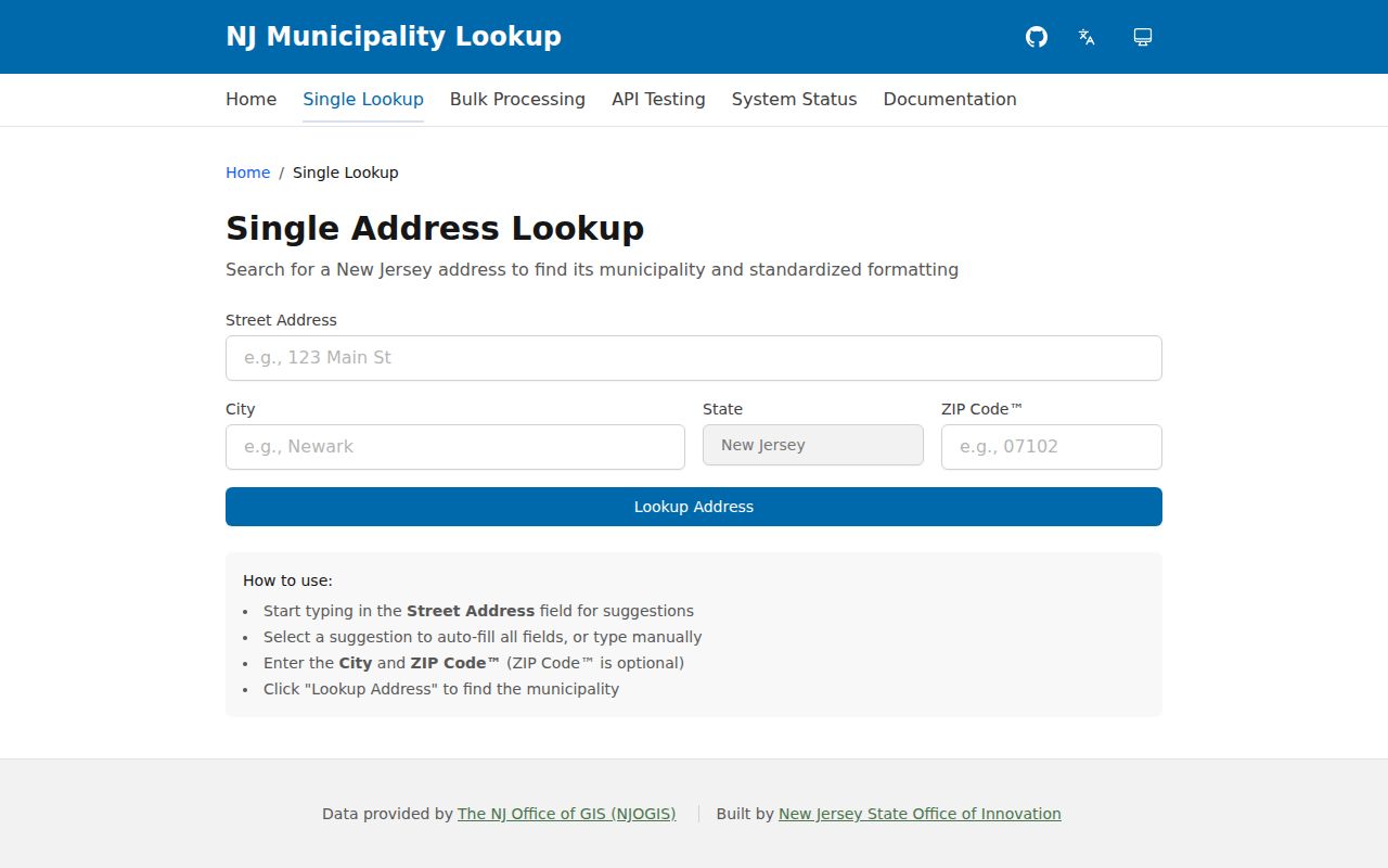
The New Jersey Municipality Lookup is the bridge between delivery geography and municipal records. It accepts a street address with autocomplete, city, state, and an optional ZIP, then provides a standardized address and municipality from an NJOGIS-backed service. Enter the complete street first. If autocomplete fails, test a directional or street-type variant. Remove a unit only when checking the jurisdiction. A unit can matter to a legitimate record, so do not discard it from research notes.
| Street Address | Autocomplete field for the complete street address. |
|---|---|
| City | Municipality input used with the address check. |
| State | State input for the address lookup. |
| ZIP | Optional postal value, useful as a check rather than a municipal conclusion. |
| Lookup Address | Action that returns standardized formatting and municipality information. |
The image below shows the New Jersey Municipality Lookup, the official address-to-municipality route used before a Newark record search.
Keep the standardized result with the source date. It helps explain why a record search belongs with Newark, a neighboring municipality, or a different county custodian.
Newark ZIP Boundaries and Limits
A postal ZIP is not a city line. It is also not a ward, voting district, historic district, parcel boundary, or neighborhood boundary. The 07105 Ironbound and 07106 Vailsburg associations can help a researcher describe a postal context, but an exact address may sit within a different civic or historic label. The official Newark ward map and historic-landmark material are separate sources for those labels. Preserve each field separately rather than making one label stand in for all of them.
- ZIP
- A postal delivery label assigned through USPS address systems, not a legal municipal boundary.
- ZIP+4
- An added delivery detail attached to a ZIP for a more precise mail route or address segment.
- PO Box ZIP
- A postal description for box service that should not be assumed to represent ordinary street delivery.
- Unique ZIP
- A ZIP associated with a particular firm or institution rather than a usual residential delivery geography.
- Carrier route
- A mail-delivery route that can organize service, but does not define a political or legal district.
The image below comes from the Census explanation of ZIP Code Tabulation Areas, which explains why a Census ZCTA is not an exact USPS delivery boundary.
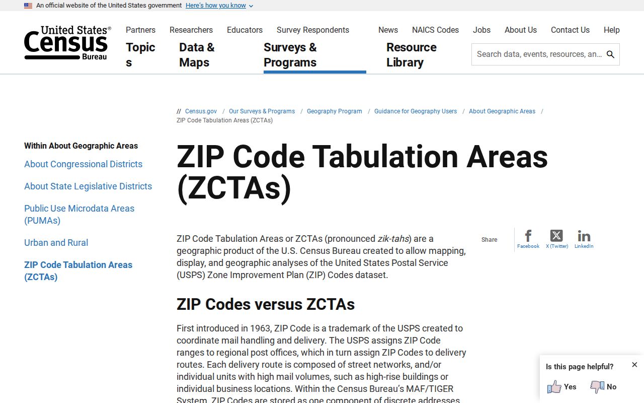
Use ZCTAs for statistical context. Use USPS and the municipality result to validate a street address. Those tasks answer different questions. Note: Census ZCTAs are statistical approximations, not a substitute for a live postal-delivery result.
Newark ZIP Code Exceptions
Two Newark ZIP descriptions deserve an early warning. Research identifies 07101 as a PO Box ZIP and 07182 as a unique or shared-firm ZIP. Neither should be treated as an ordinary street-resident area. Several standard Newark ZIPs also lack a station assignment in the official location material reviewed for this research. That absence is a reason to run the live postal check, not a reason to guess a station or neighborhood.
Address privacy matters. A map or parcel result may lawfully omit owner information under Daniel's Law. A blank field can be a correct protected result, not a gap to fill from another source.
New Jersey parcel services expressly warn that hosted parcel and tax-list data and map services redact covered owner names. The state property and parcel tools are still useful for geometry, block and lot, and map context. Keep a redaction note next to the source rather than treating the record as incomplete.
Newark Addresses Before ZIP Codes
Many historical Newark sources predate ZIP codes. A nineteenth-century city directory, atlas, deed, or Sanborn sheet should be searched by the printed street, ward, year, block and lot, or nearby names before anyone forces it into a modern postal area. The NPL chronology records Vailsburg Township's annexation by Newark in 1905. That historical jurisdiction can be important when an older directory or land record does not use the present city label.
The Newark Public Library digital directory collection covers 1835-1964 and works well with maps, newspapers, census records, postcards, and photographs. Its historic entries are dated address clues, not modern ZIP evidence. When an old address will not geocode, compare period street spelling and a map sheet before changing the address text. Note: Annexation, ward changes, and ZIP assignment are different kinds of geography and should be recorded separately.
Newark ZIP Code Geography
A careful Newark postal reference keeps municipal, political, and historic geography in separate columns. The city ward map can show wards, voting districts, blocks, parcels, and municipal geography. Historic districts such as Forest Hill, North Broad Street, James Street Commons, Military Park Commons, Four Corners, Lincoln Park, and Weequahic Park offer a preservation context. None of those labels becomes a ZIP boundary merely because an address is nearby.
| Geography | What it answers | Newark source route |
|---|---|---|
| ZIP | Postal delivery clue for a specific address | USPS live lookup |
| Municipality | Jurisdiction for municipal records | New Jersey Municipality Lookup |
| Ward or voting district | Political and election geography | Official Newark ward map |
| Historic district | Preservation and place-history context | Newark historic-landmark material |
| Parcel | Property identifier for tax and land records | Newark tax search and state parcel data |
For a final address check, use USPS, then the municipality result, then the Newark tax or parcel record. The New Jersey parcel data page supplies a map-layer fallback when geometry is needed, while the Newark tax record supplies the practical municipal account route. This sequence keeps a ZIP-based discovery search tied to the correct jurisdiction and source date.
The state property explorer is useful for map and assessed-value context, but research describes it as an annual January tax-list view. A later transfer can therefore be absent from that layer. Compare its block-and-lot result with the Newark tax account and, when appropriate, the Essex Register instrument date. The parcel layer supplies geometry, while the municipal tax index supplies a practical current account route. Each source has a separate purpose and a separate date.